Sunday, May 4, 2014

Nashville to Sylvania, GA

Nashville to Sylvania

On the road towards Chatanooga
Well we're finally getting back to the warm. Shorts and short sleeve shirt for me and summer slacks and blouse for Tina... wonderful! We were up and out by 7:30 with a quick stop for coffee at Starbucks. Then it was on the road East towards Chatanooga. Tina put in the first 90 minutes then we switched off.
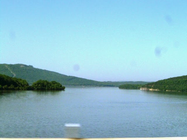
Crossing an arm of Lake Oconee
We were making a detour as part of our research for our daughters retirement plans. Marni and her husban Darren are planning to retire from the rat race in a few years and they would liker to open some sort of an expanded B&B/Guest House which would be more like a Dude Ranch without the horses. A place where people can go to enjoy themselves for a week or more in a nice country setting where they can offer, kayaking, hiking, biking, etc. We figure it will take at least a year to finalize the idea. But we have done some research on locations and there was a property that met most of their criteria, 50+ acres, water access, multiple out buildings and equipment, trails, an existing house that could be expanded to 6 or 7 rooms.

So, since we were only a day away, and the GA area within 50 miles of Atlanta met the weather conditions and access to European clientele we were making the trek to a little town called Sylvania in GA.

Leaving Chatanooga, we followed I-75 to Atlanta here we slowly eased our way through Sunday traffic that felt like Monday morning rush hour!  Once through Atlanta we picked up I-20 towards Augusta. Fifty miles west of Augusta we cut down to the south on GA-80 which took us through Warrenton, Wrens and Waynesboro (they like cities with names that start with "W") before we cut off onto GA-21 out to the property we wanted to look at.
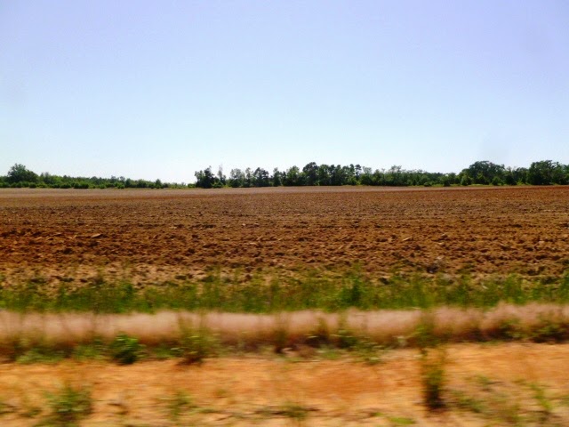
Red soil of Georgia
Georgia is beautiful in late spring. The area around Sylvania is mostly agricultural and many of the fierlds have been plowed ready for planting or already in corn and cotton. One thing that surprised us was how red the soil was in many fields. Almost orange in some cases.

Entranc Hall at Kinchley Place B&B
We arrived at the property about 5pm and found a rutted dirt road that wound past a recent clearcut and past several small "cracker" houses on the way to the home we wanted to see. We got to the property and decided that it would take too much investment to do anything with it so we turned around and drove back into Sylvania to the Kinchley Place B&B for the night.

There are only two rooms and the owners actually live in the house ext door, so we had the entire house to ourselves.

http://www.kinchleyplace.com/

Tina is ready to relax!
The owner Bob, met us and showed us around the house giving us the big bedroom. Once we brought our stuff in and got settled, we had dinner, leftovers from lunch, rather than go out for Mexican, the only restaurant that would be open on Sunday.

Formal Dining Room
We spent some time talking to Bob about the area and his experiences getting the place open. He thinks that the area might be too quiet for the type of operation our kids are looking to start. Statesboro, about 30 miles South is probably more like the area where they could attract people and provide the services they are thinking of.

Formal Sitting Room
Originally we had planned on connecting with a realtor in the area but after talking to Bob we think we can do just as well getting info from the web until the kids are ready to maker a move. Plan first, action second.

Tomorrow we will enjoy a leisurely breakfast then head South for a stop in Ocala before making the final leg home on Tuesday.

To see all our photos from today, go to:

http://picasaweb.google.com


Saturday, May 3, 2014

Columbia to Nashville

Columbia to Nashville

Up early to shower and get started. Took the kids down for their morning walk and it was WARM!! Unbelievable! It was probably 62 or 63 outside! Once we got the dogs fed and in the we took all the bags and gear down and packed the car for the days journey. But first a quick stop at Starbucks for oatmeal and a good cup of joe, then it was onto I-70 E for the leg into St Louis.

Light traffic on I-70 E towards St Louis
With Tina driving and very little traffic we covered the first 80 miles in an little over an hour. That's when she noticed we needed gas. So we pulled over and tanked up. I took over the driving chores as we continued on to St Louis. Traffic started to pick up in St Charles about 14 miles outside of St Louis.

Add caption
Tina captured this overpass from the St Louis Science Center to the McDonnell Planetarium just on the outskirts of downtown St Louis.

First glimpse of the Gateway Arch

Add caption
 We got to see the Gateway Arch from many places as we passed through St Louis but this was the best one. Shortly we crossed the Mississippi River leaving Missouri and entering Illinois.

Bridge over the Ohio River
Our route took us south through Illinois to the Ohio River where we crossed into Kentucky. Soon we were passing the Cumberland River and on to the border with Tennessee.

Mustard fields
Along the way we passed numerous fields covered in a carpet of yellow, we suspect it was mustard in full bloom! Very pretty!


Tina about to enter Antique Archeology
Finally we entered Nashville and cut over to visit Antique Archeology's Nashville Store. It was just as cool as on TV!

The view looking into the store from the front door


The famous Pig!

High Wheeler

Famous Drag Bike

Unrestored Indian

Original Marketing to to Drum up business

The famouse Arrow

Tina and Loren
 After Tina got her picture taken with Loren we headed for the LaQuinta Inn on the other side of town. After registering and getting our gear to the room we took an hour to relax before going to dinner. We went to a very nice family restaurant about a mile away and had a couple of great salads for dinner then it was back to our room where we tucked in for the night to watch a little TV before hitting the sack.

To see all our photos from today go to:

http://picasaweb.google.com/mjdolanski


Friday, May 2, 2014

North Platte to Columbia

North Platte to Columbia

There are a lot of mountains in this grand country of ours!
Once again we had a cold, frosty morning. I took the kids out right after they had their breakfast. Then with everything packed and ready to go we went down to breakfast. After fueling up with coffee, we tanked up the car and began our days drive to Columbia, Missouri.

Tina took the first leg and after an hour we stopped in Kearney for Starbucks, just a short (4 mile) jaunt to a real cup of coffee, but worth it. A thriving town filled with young people, it speaks to the strength of the heartland! With a quick stop for doggy treats we were back on the road to the freeway.

Add caption
Not too much further on we saw a huge smoke cloud and thought it might be a house fire.

Controlled burn
But it turned out to be a controlled burn in a corn field.

The rest of the drive through Nebraska was pretty uneventful until we got to Lincoln City where traffic got heavy but we were soon through it and into Ohio for a few miles where we stopped for lunch at a major truck stop just before crossing into Missouri.

Monument to Lewis and Clark
After gassing up we were back on I-29 which follows the Missouri River past St Joseph and through Kansas City at rush hour! Soon we made it through all the traffic and onto I-70 East until we got to Columbia where we made our stop for the night.

To see all our photos go to:

http://picasaweb.google.com/mjdolanski


Sheridan to North Platte

Sheridan to North Platte

Up very early and on the road by 7:15am. Grabbed a quick bite at Starbucks then w hit the road. It was a beautiful morning but it was about 31 degrees and there was frost on the car. Brrrrr!!!

It's a long way to Tipperary!!
A stunning day for a drive the terrain is varied with cattle fields and rocky out crops.

Larramie Range
The drive took us South along the Bighorn Range through Buffalo and down towards Casper. As we crested the last ridge before hitting Casper, we saw the Laramie Range stretching out from West to east, covered in snow.

Casper Mountain
Casper sits at an elevation of 5,200 feet so you don't have to go very much higher to find the snow. As we drove through Casper, the road curved East to parallel the Laramie Range. This is a shot of what is called Casper Mountain, a long mountain at the north end of the Laramie Range overlooking Casper and the North Platte River. At an elevation of 8,100 feet, it towers over Casper and is visible from space.  

Southeast end of the Laramie Range
We continued East following the North Platte River on I-25 to the Torrington cut-off which took us on a diagonal across the plains through Scotsbluff and down to Ogallala where we picked up I-80 E to North Platte and our stop for the night.

To see all our photos from today go to:

http://picasaweb.google.com/mjdolanski